UN
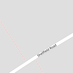
5 Shellfield Road
£ 255,000
Description
We don't have a Description for this property.
- Bedrooms
- 4
- Bathrooms
- 0

Leaflet © OpenStreetMap contributors
The heatmap indicates the level of crime in the area. The color of the heatmap indicates the crime severity and recency.
Metrics Year-on-Year
- Average area value
- 256,098.00 £Decreased by 14.07 %
- Average area rental value
- 1,156.00 £/moDecreased by 1.62 %
- Est rental Yield
- 5.42 %Increased by 14.59 %
- Crime Rate
- 5.00 %Unchanged by 0.00 %
from 298,041.00 £
from 1,175.00 £/mo
from 4.73 %
from 5.00 %
Nearby Schools
| Name | Type | Ofsted | Distance |
|---|---|---|---|
| St Patrick'S Catholic Primary School | Voluntary Aided School | Outstanding | 0.57 KM |
| Marshside Primary School | Community School | Requires improvement | 0.62 KM |
| Presfield High School And Specialist College | Community Special School | Good | 0.64 KM |
| Peterhouse School | Non-maintained Special School | Outstanding | 0.66 KM |
| Crossens Nursery School | Local Authority Nursery School | Outstanding | 0.66 KM |
Images
Nearby Streets
| Name | Average Price | Average Sqft | Distance |
|---|---|---|---|
| Manx Janes Lane | £ 0 | 0 | 0.00 KM |
| Beresford Drive | £ 295,000 | 0 | 0.00 KM |
| Montrose Drive | £ 276,590 | 0 | 0.00 KM |
| Carisbrooke Drive | £ 0 | 0 | 0.00 KM |
| Moss Lane | £ 409,000 | 0 | 0.00 KM |
Nearby Transport
| Name | NLC | TLC | Distance |
|---|---|---|---|
| Meols Cop | 2357 | MEC | 2.60 KM |
| Southport | 2262 | SOP | 4.51 KM |
| Birkdale | 2352 | BDL | 6.39 KM |
| Bescar Lane | 2351 | BES | 7.70 KM |
| Lytham | 2670 | LTM | 7.90 KM |
Nearby Listings
| Address | Price | Type | Score | Distance |
|---|---|---|---|---|
| Lytham Road, Southport, PR9 | £ 225,000 | BUY | 7 / 10 | 0.12 KM |
| Lytham Road, Southport, Merseyside, PR9 | £ 180,000 | BUY | 6 / 10 | 0.12 KM |
| Lytham Road, Southport | £ 225,000 | BUY | 6 / 10 | 0.12 KM |
| Ansdell Grove, Marshside, Southport | £ 220,000 | BUY | 7 / 10 | 0.21 KM |
| Fylde Road, Southport, Merseyside, PR9 | £ 330,000 | BUY | 7 / 10 | 0.21 KM |
Nearby Properties
| Address | Price | Distance |
|---|---|---|
| 5 Shellfield Road | £ 255,000 | 0.00 KM |
| 53a Shellfield Road | £ 236,250 | 0.00 KM |
| 55 Shellfield Road | £ 175,000 | 0.00 KM |
| 51 Shellfield Road | £ 160,000 | 0.00 KM |
| 1 Shellfield Road | £ 160,000 | 0.00 KM |